Can New Radar Technology Predict Weather in Neighborhoods?

(TNS) — A new radar system coming to the Bay Area promises to greatly improve weather predictions, providing additional warning time to prevent flooding damage and more accurate forecasts of where heavy rainfall will hit, down to a specific low-lying highway or neighborhood.
The new forecasting system was originally geared to give emergency planners more time to prepare before a sewage plant overflowed or a BART station flooded during an atmospheric river, the often-dramatic weather events responsible for up to half of the region’s rainfall. Paid for in part with a $20 million grant from the California Department of Water Resources and implemented by local water districts, the $31 million system began rolling out in 2018 with the installation of a new weather radar station in Sonoma County, followed by one in San Jose. By 2024, five more will come to the Bay Area, including one in the East Bay by Thanksgiving. An additional radar station will also be installed in Santa Cruz.
The new tools also hold promise for mitigating effects of global warming besides atmospheric rivers. More accurate forecasts could help water managers strategize reservoir storage to better prepare for drought, and the higher-resolution images could monitor heavy rain that might hit wildfire burn zones and cause mudslides.
Atmospheric rivers, huge airborne bands of water that travel thousands of miles across the Pacific to dump rain and snow as they hit land, are estimated to inflict $1.1 billion in damage annually in California, Oregon and Washington. The forecasting system, called Advanced Quantitative Precipitation Information, or AQPI, could reduce the annual cost of flood damage in the Bay Area by $60 million, said Robert Cifelli, research meteorologist at the National Oceanic and Atmospheric Administration and AQPI technical lead.
“We can actually see these atmospheric rivers coming many days in advance,” Cifelli said. “The question is exactly where is it going to hit and how intense is it going to be. And that’s where the devil’s in the details.”
The forecasting system aims to provide those details, as the new radar stations will cover more ground and provide higher-resolution images and quicker updates. It will especially improve what is called nowcasting — updates on what is happening in the next 30 to 60 minutes — which can be vital in an emergency.
One scenario: AQPI could predict that heavy precipitation will fall around the east entrance to the Bay Bridge during the evening commute — perhaps when there is also a king tide, raising the chance of intense flooding. In that case, an emergency text message could be blasted out, urging people to avoid the bridge.
“With climate change and sea level rise, a lot of the impacts are going to be felt on our interior highways around bridges,” said John Coleman, CEO of the Bay Planning Coalition, an organization that represents the economic interests of governments and businesses in the region. “AQPI can really direct down to almost the neighborhood what the impact of the storm will be.”
The Bay Area has particular weather forecasting challenges. Since precipitation generally moves west to east, it’s difficult to get close enough to storms that are coming from the Pacific. Also, the radar system we have is limited by the area’s hilly topography, Cifelli said.
The Bay Area also has pockets that get hit hard by atmospheric rivers, particularly the Russian River Valley in Sonoma County, which experienced flooding most recently in early 2019. On the flip side, the county has been heavily impacted by drought. Both are reasons that Sonoma County’s water agency took the lead on bringing the state-funded AQPI project to the Bay Area.
“In February of ’19, we had 2 or 3 feet of water running down the middle of Guerneville, and seemingly it hasn’t rained since,” Sonoma County Supervisor and water director David Rabbitt said. “It’s really important to have a better handle (on that). Technology can offer a lot.”
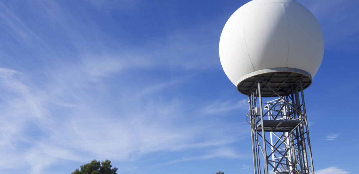
Weather radar works by sending out radio signals that hit raindrops and then bounce back. That data is used to map the location, intensity and direction of the rainfall. That real-time information, along with weather data from other sources — satellites, rain gauges, even buoys at sea — is used for nowcasting and is fed into algorithms that meteorologists use to forecast precipitation. The more information that goes into the models, the better they work during future storms.
Currently, most Bay Area weather forecasting is handled by four main radar stations, called Nexrad, which have some gaps in coverage. The signals from the Nexrad radar station on Mount Umunhum in the Santa Cruz Mountains is at 3,500 feet and can miss rainfall from an atmospheric river heading over San Francisco, for example, because its beams often skirt over the city at too high an elevation because of the curvature of the Earth. Another, in Davis, misses much of southern Sonoma County because mountains block its signals.
“We’re trying to fill in as many gaps as we can where those radars are blind,” Cifelli said.
Six of the new radar stations being rolled out are being placed close to dense urban areas. They’re all X-band radar, which has a smaller range than the Nexrad S-band radar but captures a crisper image, down to 200 feet of resolution compared with 0.6 of a mile. X-band radar also updates every two minutes compared with six minutes for the Nexrad, and because the stations will be located at a lower elevation, where precipitation from atmospheric rivers tends to occur, they can also provide a more accurate assessment of where the rain is falling, Cifelli said.
Yet meteorologist Jan Null of Golden Gate Weather Services, a 47-year veteran of Bay Area forecasting, is doubtful about the impact the new X-band radar will have because of its limited range. He said he doesn’t think the stations will provide enough lead time to prepare for an emergency, unless additional meteorologists were hired to interpret the data.
“With a storm system coming in that’s moving at 30 miles an hour, you don’t see very far into the future,” he said, adding that the new system will not be a “big value add.”
“It’s not going to make a significant difference in the way forecasts are issued,” he said.
However, one of the new radar stations is C-band radar, which has a larger range than X-band, and will be installed on the Sonoma coast to capture atmospheric rivers as they head toward the region.
That new C-band radar station is the one that meteorologist Brian Garcia of the National Weather Service is most excited about. Currently there are only two radar stations that face the ocean without being “beam-blocked” by mountains, he said — the one on Mount Umunhum and another in Eureka in Northern California. The new radar station will help forecast weather heading toward Marin, Sonoma and Mendocino, he said.
Even after they’re up and running, Garcia said it will take a while for the new AQPI radar stations to improve weather forecasting, but once they do, it will be a big improvement.
“People should not expect this to be like an app on your phone that’s going to tell you when it’s going to rain and how hard it’s going to rain, and that you need to evacuate,” he said. “What this is is a huge leap forward in the quantity and quality of data that we are getting on the environment during critical weather situations.”
© 2021 the San Francisco Chronicle. Distributed by Tribune Content Agency, LLC.
link


